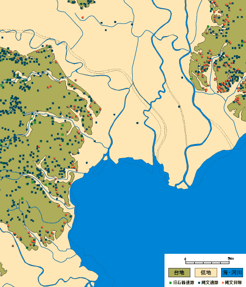
 LEGENDS:
This is a distribution map of archaeological sites around the north end of Tokyo bay, only for sites Palaeolithic, Jomon, and shell midden. The coastline is based on "Jinsokuzu" surveyed in Meiji 10's (around 1880). Heights, dark green area, in the left is Musashino terrace of Tokyo, and the right is Shimousa terrace of Chiba prefecture. Lowland area, which is alluvial plain, was mostly once sea, thousands years ago.
Shell midden mostly distributes in the end of terraces, especially around the valley near the sea.