|
|
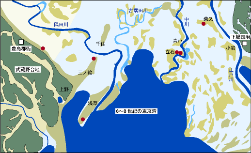 LEGENDS:
The map shows estimated coastline in the Kofun period (6-8c.). Archaeological sites mostly situate on the bank (slight heights such as natural levee, coastal dune or sand bank) which distribute here and there on the alluvial plain.
Lowland Kofuns are rare and not well researched so far. On the other hand, dense distribution of the Kofuns, not expressed in the map, are known on the terrace heights.